


Land Surveying, Civil Engineering, Planning, Project Management and Land Development
Challenge. Create. Solve.
The next generation
We lead with ideas that make a difference for New Zealand and its people, shaping a better future.
Bonisch offers a range of land development related services which include surveying, planning, project management, civil engineering, and resource consent applications.
We have a team of high-skilled, experienced, and qualified professionals who can help decipher land complexities for construction projects and redevelopments. Our innovative solutions are tailored to meet the unique needs of each project, ensuring sustainable growth and development that benefits both people and the environment. Our team is always considering how we can make a positive difference for the residential, commercial and industrial sectors of the country.
From our offices based in Invercargill, Christchurch, Te Anau, we deliver projects nationwide. If you have a project that involves land development, get in touch with the office closest to you, or send us a message.
Featured Projects
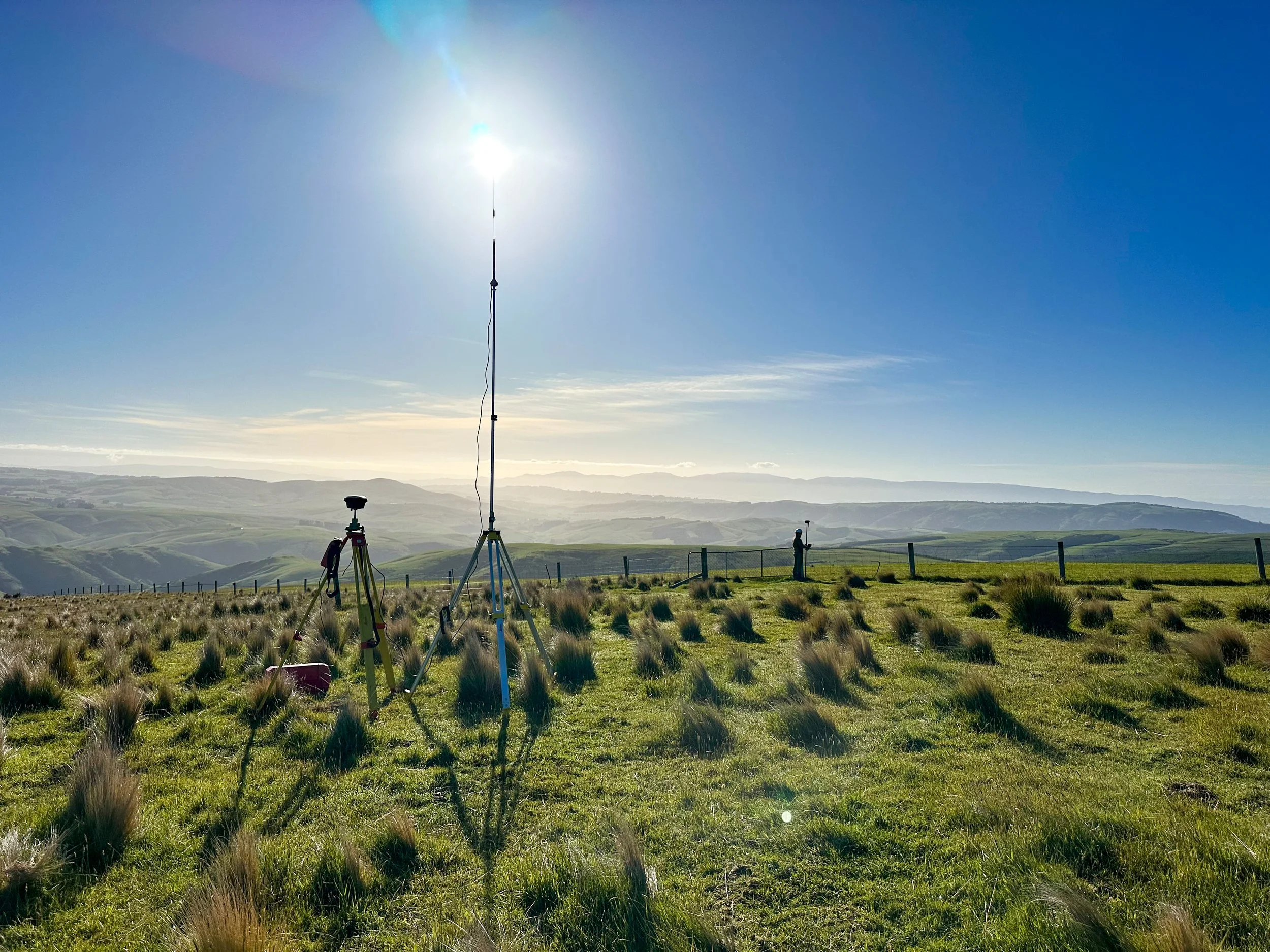
Hukarere Station's tenure review was about establishing the framework for future ownership, conservation, and public access across a significant high-country landscape. Delivering that outcome required a complex cadastral survey to accurately define and legally establish each new land interest.
A pastoral lease is a form of Crown-owned land that is leased to runholders for farming and grazing. Through the tenure review process, parts of the lease may move into private ownership, while other areas may be retained for conservation, public access, or the protection of significant natural features. These decisions can fundamentally reshape how a property is owned, managed, and accessed into the future.
Hukarere Station required the conversion of a complex tenure review proposal into legally recognised property boundaries, creating the cadastral framework that now underpins future ownership, conservation management, and public access across the property.
Challenge
Hukarere Station wasn't a typical cadastral survey. The tenure review proposed creating a range of new land parcels, including freehold land, conservation areas, public access routes, easements, hydro areas, covenants, and marginal strips. Before any of these could be legally recognised, every boundary needed to be accurately located and defined on the ground.
Many of the survey records underpinning the property were decades old, with some cadastral information dating back more than a century. Re-establishing and redefining boundaries required careful interpretation of historic survey plans and evidence before new boundaries could be accurately positioned and legally defined. Existing fences didn't always align with legal boundaries, natural features such as rivers and streams added further complexity, and the final survey needed to satisfy the requirements of LINZ and multiple stakeholders.
Create
Working for Landward Management, our survey team spent months interpreting the tenure review proposal and converting it into a legally defined survey. The work combined extensive field surveying using GNSS and total station technology with detailed research into historic survey records, boundary evidence, and existing land interests.
Each proposed parcel, easement, covenant, hydro area, conservation area, and access corridor had to be carefully assessed and legally defined so the final outcome reflected both the intent of the tenure review and the realities of the landscape. The resulting work formed Survey Office Plan SO 600014, providing the legal framework required to implement the tenure review.
Solve
The completed survey turned a complex land tenure proposal into legally defined boundaries that can now be relied upon by landowners, government agencies, and future generations. What existed as a concept on paper was transformed into a clear and enduring cadastral framework defining exactly where ownership, conservation land, public access, and other land interests begin and end.
Projects of this nature require surveyors to piece together historic information, modern survey measurements, and physical evidence on the ground to create certainty where uncertainty previously existed. The result is a legally robust survey framework that will continue to support the management and protection of the land long into the future.
The quality and complexity of the work were recognised nationally when Graeme Crouchley received the 2025 Cadastral Survey of the Year Award for his work on the Hukarere Station tenure review project.
This project reflects the type of surveying work Bonisch thrives on, interpreting historic boundary information, solving complex land tenure challenges, and creating legal boundaries that will stand the test of time.
Services Provided
Cadastral Surveying
Tenure Review Implementation
Survey Office Plan Preparation
Easement and Covenant Definition
Hydro Area Mapping
GNSS and Total Station Surveying
LINZ and Stakeholder Coordination
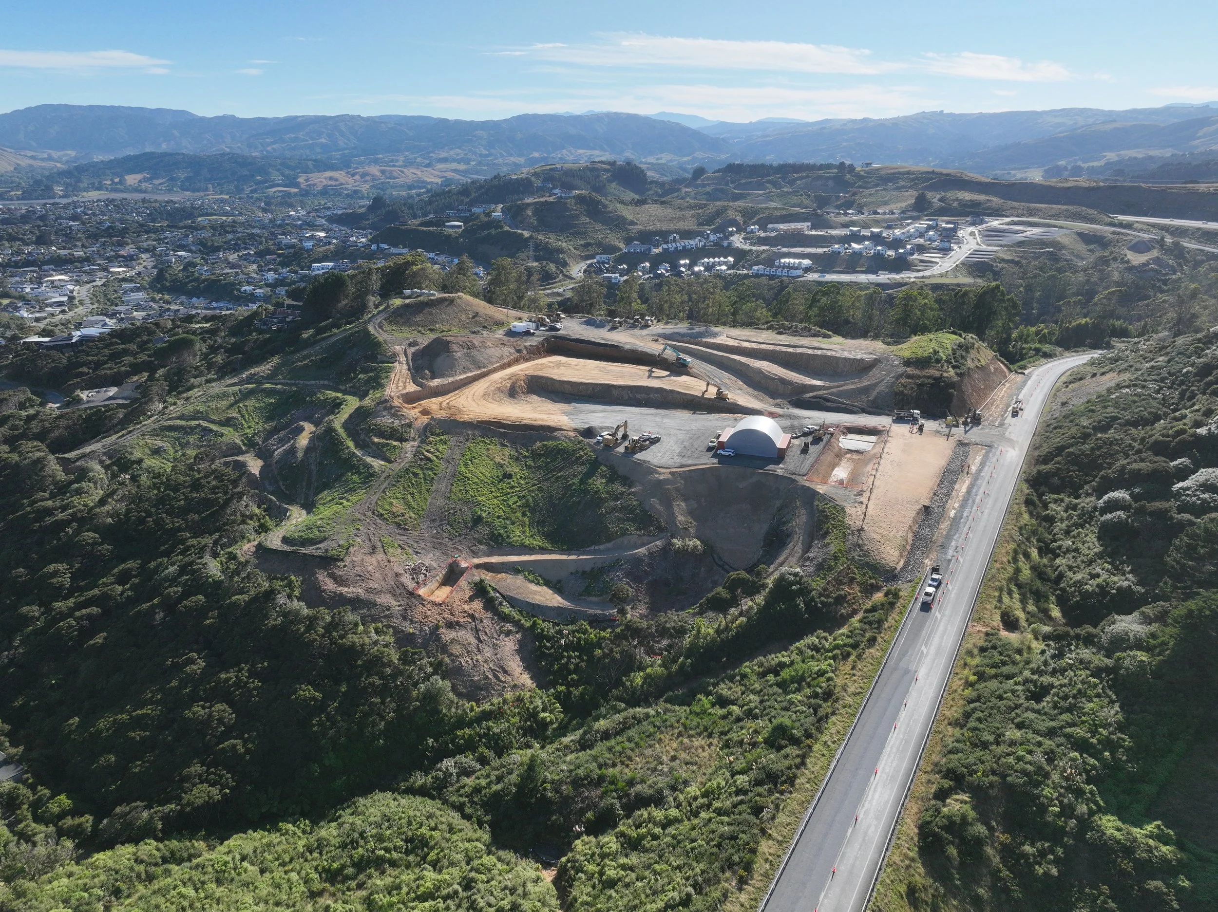
This project involves the development of a large-scale aged care village across a 10.75ha site in Whitby, Porirua. The works include bulk earthworks, roading, and three waters infrastructure to support the staged delivery of villas, apartments, and a central care and community facility for one of our key aged care partners.
Bonisch has been involved across the full project lifecycle, from early due diligence and consenting through to detailed design and construction, working closely with Porirua City Council, Wellington Water, Greater Wellington Regional Council, and the wider project team to coordinate delivery.
The Challenge
The site presented a number of significant challenges, including steep topography, geotechnical considerations associated with the existing landform, a sensitive receiving environment, and effectively no available capacity within the surrounding three waters networks.
These overlapping constraints significantly limited how the site could be developed and required careful management to mitigate environmental effects and respond to surrounding infrastructure limitations.
The Solution
The design brings together earthworks, roading, and three waters infrastructure into a single coordinated approach.
The earthworks model was driven by the need to maximise the building platform to support a well-functioning aged care village, while responding to the natural form of the site and underlying geotechnical constraints. The final landform was developed in close collaboration with the project geotechnical engineers and refined throughout the design process.
A reinforced soil slope was adopted to manage the significant level changes across the site, providing a practical and efficient solution that complements the surrounding landform.
The earthworks were further optimised to achieve a cut-to-fill balance as far as practicable, maximising reuse of site-won material and reducing reliance on import or disposal.
In parallel, the servicing strategy responds to the limited capacity within the surrounding three waters networks, incorporating stormwater and infrastructure solutions to enable development while managing downstream effects.
This approach has enabled the formation of a development platform of approximately 5.11 hectares, providing a buildable foundation for the project.
Project Progress
The project has progressed through consenting, detailed design, and into construction, with all key approvals, engineering acceptance, and regulatory pathways now in place.
Construction is underway, with bulk earthworks and reinforced soil slope construction progressing across the site. These works are transforming the site into a formed development platform that will enable the staged delivery of the aged care village.
The next phase of the project will see the ongoing delivery of civil infrastructure and building platforms to support future vertical build stages. Subject to construction sequencing, the first stage of approximately 30 villas is currently targeted for handover in early 2027.
Outcome
This project demonstrates Bonisch’s ability to deliver complex developments through a practical and integrated design approach.
By aligning earthworks, roading, and three waters infrastructure, the project maximises developable area while maintaining stability, manages environmental effects within a constrained setting, and provides a platform that supports efficient construction and long-term performance.
The result is a coordinated and practical development platform that enables the next stages of the project to be delivered with confidence.
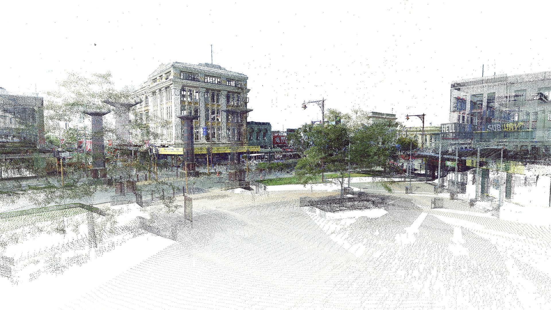
What is laser scanning?
Laser scanning, a form of land surveying, has emerged as a fast and accurate method to capture spatial details of existing buildings and structures. By utilising advanced high-definition laser scanners, this non-invasive technology collects precise geometric data from both exterior and interior environments.
Why choose Bonisch?
While laser scanning might appear as plug-and-play technology available to anyone with a tripod, the fundamental principles of surveying remain pertinent in data capture of this kind. With over four decades of experience, we harness this extensive knowledge to ensure a successful project outcome.
Our approach starts by understanding our client's needs and assessing whether laser scanning is the optimal tool for the task. Our process involves a holistic understanding, recognising the significance of data redundancy. All point clouds are not equal and stand by our quality assurance process to ensure successful capture.
Back in our office, we meticulously extract data aligned with project requirements, delivering outputs compatible with software tools like Revit or ArchiCAD, streamlining design collaboration.
Laser scanning has revolutionised spatial data capture and design efficiency, offering numerous benefits for the construction industry. Its ability to expedite surveys, foster collaboration, identify potential issues, and integrate with software tools makes it an asset for professionals and their clients alike.
Invercargill Re-Development Block
An example of our laser scanning services includes our involvement in the Invercargill re-development block. Due to our early involvement as part of the development team we were able to offer our laser scanning services.
The challenge from Invercargill Central Limited was the need for an accurate exterior survey of all block buildings prior to preservations/demolition. They also sought a historical reference of the heritage structures, be it for preservation or for historical context. Recognising that laser scanning was the ideal tool for the task, our team of experts committed to delivering the required level of service.
We highlighted that laser scanning was the right tool for the job, and that the Bonisch team of experts could provide the level of service they needed.
The project involved comprehensive data capture of the city block, meticulously referencing both vertical and horizontal datums. Our laser scanner provided a swift and efficient solution for the extensive data captured.
The result was a detailed scanning survey and associated dataset to a known accuracy. This data now lives as a historical record at a point in time for Invercargill City and can be referred to for a variety of needs for now and in the future.
Bupa Care Facility, Christchurch
Another project reference that utilised our laser scanning services is the Bupa Care facility in Ilam. Due to our long-standing relationship with Bupa, the Bonisch team have had project involvement within previous stages of this project.
Bupa wanted an accurate exterior survey of the exterior of an existing apartment block to assist with the interface of a proposed building extension. Along with this, Bupa was looking to de-risk the design extension by scanning the exterior of the existing building an integrating this into the project Building Information Model (BIM).
The project included the full data capture of the existing building, with reference to the historical grid line setout and finished floor level datums. The result was a comprehensive scanning survey with extracted data tailored to the client’s requirements, all of which were seamlessly integrated into the project’s BIM. This offers a digital replica of the building, ensuring precise design of the extension.
For more information on these services, contact admin@bonisch.nz

Client
Bonisch has been a valued participant on the Southland District Council (SDC) Professional Services panel since 2017, collaborating to improve and rehabilitate SDCs extensive road network. Our long-standing partnership has enabled us to work closely with the council, refining the transportation experience for both residents and visitors alike. We have undertaken significant improvements to their considerable road network which consists of over 2000km of sealed roads that connect various communities across the district.
Challenge
Following our successful tender and subsequent inclusion in the inaugural Professional Services Panel in 2017, Bonisch have undertaken a series of road rehabilitation projects each year as part of the SDCs pavement rehabilitation programme.
The standard project brief includes comprehensive topographical surveys, in-situ testing, drainage improvements, geometric design, safety improvements, creation of tender documentation and contract documentation, tender evaluation, contractor procurement and Engineer to Contract Services for SDCs predominantly rural rehabilitations.
With our multi-disciplinary approach, we seamlessly integrate a wide range of specialised services into each project. Our in-house survey capabilities are utilised to check road corridor boundaries and our drone services are used to provide pre and post aerial imagery across the projects. By harnessing advanced technologies like drone aerial surveys and LiDAR point scanning, we gather accurate and detailed data about the project sites with the ability to save excessive survey costs. In instances where technology’s scope is limited, our experienced surveyors conduct on-site topographical surveys, providing precise measurements and crucial information for planning and design purposes.
Moreover, we actively consider local planning regulations to consider environmental regulations like stormwater discharge, zoning laws and land acquisition to secure road areas necessary for widening projects. By addressing all aspects of the challenge, we optimise road capacity, safety, and longevity.
Create
Throughout our collaboration with the Southland District Council, we have tackled various challenges and intricacies associated with road rehabilitation projects. Our experienced team has successfully navigated the complexities of handling complex horizontal alignments, such as switchback curves through to intersection redesign, to ensure optimal roadway safety and efficiency. We analyse and assess vertical alignment geometry to improve cost outcomes while considering the ultimate purpose of the project. Safety considerations are never excluded, like analysing sight lines and sight stopping (braking) distances, guaranteeing that drivers have adequate visibility and reaction time on the rehabilitated roads. Bonisch have led the way in supplying construction setout data compatible with the contractors GPS machine control and setting the standard for all others to follow.
In our commitment to excellence, our qualified tender evaluators thoroughly assess tenders to select the most capable and reliable contractors, ensuring the successful execution of each project. Our expertise transcends conventional engineering, as we seamlessly integrate stormwater design and planning regulations. This approach ensures a harmonious and cohesive road network, that maximises the existing environment’s potential while minimising impacts on neighbouring properties wherever possible. This synergy enhances the overall infrastructure quality, resulting in a seamless travel experience for road users.
Solve
By blending our technical expertise, cutting edge survey and design techniques, and meticulous planning, Bonisch consistently deliver high-quality road rehabilitation projects for the Southland District Council. Our unwavering dedication to innovation, safety, and client satisfaction drives us to continuously exceed expectations and contribute to the development of resilient and sustainable road infrastructure.
Testimonial
Bonisch have demonstrated thorough knowledge with Southland Districts pavement rehabilitations and providing virtuous recommendations given the intricacies of balancing asset need with political views all within the constrained budget environment we are controlled by. Care is taken to make sure Southland specific desires are met at an input level as well as making sure we understand what the final designs and associated documentation mean along with the associated risks and consequences of any deviations Council choose. Bonisch have provided Council with the confidence we desire when designing and procuring our pavement rehabilitation works programmes.
Roy Clearwater – Southland District Council Roading Asset Manager

Client
The Peninsula Hill development is associated with notable individuals recognised by many Queenstowners, namely Mike Mee and Liz Dickson. They are the children of Frank Mee, who acquired Peninsula Hill through the purchase of Kawarau Falls Station in 1960.
In addition to its captivating historical background encompassing farming and the renowned Deer Park Heights animal farm, Peninsula Hill boasts a remarkable natural landscape characterised by north-facing sloping contours on the edge of Lake Whakatipu. This distinctive terrain offers potential buyers the opportunity to seamlessly integrate their residences into the surroundings, ensuring breathtaking views and optimal privacy.
With previous recommendations placed forward by the Bonisch team, Mike felt that we understood his vision for the development and that we would be the best team to bring this vision to life.
Challenge
Bonisch was commissioned to undertake a comprehensive master planning project encompassing the residential zoning of the entire site. From its inception, the project has fostered a collaborative approach, gradually evolving from a master plan to a developed design concept centered around eco-living principles. Throughout the process, paramount importance has been given to upholding the sanctity of the landscape and the environment, resulting in multiple iterations and refinements of the design to ensure the preservation of these core values.
The overarching vision was to realise a prestigious subdivision that upholds uncompromising design standards while demonstrating a steadfast commitment to respecting and safeguarding the natural surroundings upon which it would be built.
Create
The steep topography has proven to be challenging. From building pad level designs, stormwater pathway challenges, and protection of waterways and (wetlands) – every effort has been taken to consider the environment and to optimise the land. The complexity of this project has been substantial.
Driven by a shared vision for the site, the Bonisch team collaborated closely with Mike, as well as the specialised teams at Baxter Design and Studio Pacific Architecture, to meticulously masterplan the development of this exceptional parcel of land.
The initial phase, known as Stage Two (Karearea), will witness the introduction of 17 carefully curated sites that boast breathtaking vistas of the lake and mountains. Every site has undergone meticulous planning to guarantee unobstructed views, necessitating extensive earthwork operations and unwavering dedication to bringing this vision to fruition.
Solve
This collaborative project has yielded a prestigious development encompassing multi-million dollar sections, ranging from a minimum size of 1000 square meters to sites in excess of 3,694 square meters. Distinguished by its complexity and meticulous attention to detail, this project stands apart from anything else in the Southland / Central Otago regions.
The construction of Stage Two is projected to conclude by the end of this year, while Stages Three - Seven, comprising 67 lots, will be completed in a phased manner from 2024. Earthwork preparations for Stage Three are scheduled to commence this summer, with a concerted effort to achieve completion by mid-2025.
Peninsula Hill represents an unparalleled offering on Queenstown's Kelvin Peninsula. This premium residential subdivision will ultimately encompass an array of high-end neighborhoods and a village precinct.
Anticipation for Peninsula Hill is exceptionally high, owing to the scarcity of large, sunlit sites near Lake Whakatipu. Upholding the visual appeal of Kelvin Heights has been of paramount importance throughout the project's development.
Project Details
Name of the project: Peninsula Hill Development
Completed: Ongoing
Location: Kelvin Heights, Queenstown
Project value: $ 150 million
Project team: Boyd Wilson, Simon Collie, Brad Sayer, Christine McMillan and Graeme Crouchley

Client
Bonisch, in partnership with Isthmus and our sub-consultant partners, has had the privilege of working with the Invercargill City Council (ICC) and its residents in their endeavour to cultivate a warm and welcoming city, working on the Invercargill City Centre Streets project, which forms part of the City Centre Master Plan (CCMP).
Bonisch’s relationship with the ICC is greatly valued, and we take pleasure in participating in projects that contribute to the improvement of the local community. In addition to this engagement, Bonisch is actively involved in various ICC projects, including infrastructure renewals, surveying, planning, drone operations, and project management.
Challenge
The City Centre Streets project’s first stage included the complete renovation of Invercargill’s two main central business district blocks on Esk Street and Don Street. The purpose was to create an attractive, interconnected environment that encourages people to linger, shop, discover, and participate in the city's life. The goal of the project was to promote pedestrian traffic throughout the city centre shifting away from a focus on parking directly in front of specific shops. The objective was to transform Esk Street into a pedestrian-friendly civic area while strengthening Don Street's entertainment focus.
Create
Bonisch was entrusted as the civil engineering lead for the project, which had an overall budget of approximately $20m. We worked in partnership with Isthmus (the landscape architect lead) with Bonisch responsible for the surveying, civil design, construction quality assurance, and Engineer to Contract components.
The project was ambitious, aiming to strike a balance between the community’s appreciation for open and spacious areas and the creation of communal spaces for daily use. The design also sought to foster a renewed relationship with the environment, resulting in a visually appealing and enjoyable urban area.
The engineering component required to support and enable the project was complex and varied. This included a water-sensitive urban design with custom rain gardens in both streets to treat stormwater runoff, associated sub-surface retaining walls, 3 waters infrastructure renewals, geometric design of the street to improve stormwater performance and pedestrian functionality with complete re-design of the surface contour, along with high amenity pavement design over soft ground conditions. In addition to the above, we delivered the full construction survey and setout to tight tolerances, with work tying into level threshold historical proposed new buildings, as well as Engineer to Contract services for the overall construction cost-reimbursement contract.
Solve
Despite the challenging timelines, Bonisch delivered high-quality outcomes and timely outcomes. Through our work on this project, we showcased our in-house expertise in delivering complex Engineering projects in partnership with our clients, and our network of supporting sub-consultants.
By spearheading the enhancement of two prominent streets as part of the City Centre Master Plan (CCMP), the southernmost city in New Zealand has successfully created a dynamic and interconnected environment that encourages individuals to linger, shop, discover, and actively engage in the vibrant life of Invercargill.
Project Details
Name of the project: Invercargill City Centre Streetscapes
Completed: April 2023 Opening
Location: Invercargill
Project value: $ 20 million
Project lead: Simon Collie, Engineering Divisional Manager
Project team: Brad Sayer, Nick Watt, Brent Edgerton and Ethan Yeo
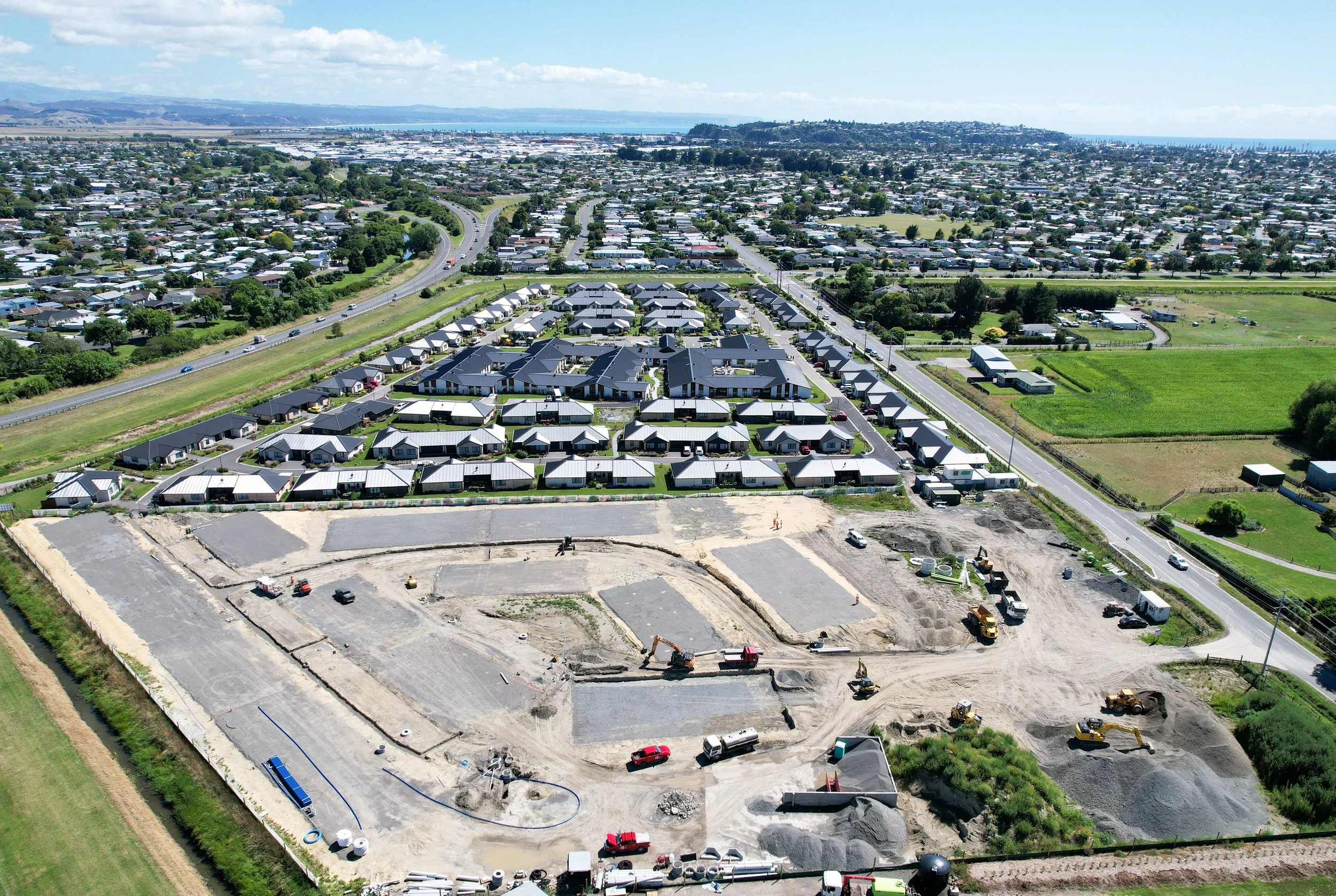
Bupa | Napier, Hawkes Bay
Bonisch has been involved with over 50 aged care facilities nationwide from Invercargill to Kerikeri. For the Bupa Napier project, which was for the development of a retirement village comprising a care home and villas across a 5-hectare greenfields site, Bonisch was engaged as the lead consultant responsible for the investigation, detailed design, tendering and MSQA of civil components of the project.
The project included extensive earthworks and recontouring design of the site with approximately 60,000m³ of imported fill required to lift the site to achieve minimum finished floor levels, 3 waters design of 4km of main networks including extension of council networks to service the site, full road geometric and pavement design of 1.2km of internal roads and 350m of existing road widening along with a full 3D model of the site.
As the lead consultant, Bonisch engaged specialist subcontractors to complete full geotechnical assessment and foundation design as well as streetlight and power reticulation as part of our scope. This project is currently under construction.
Bonisch’ delivered this large-scale project within an extremely tight timeframe, with a project commencement to tender timeframe of only 3.5 months. One of the challenges faced on this project included the design of a stormwater system that allowed for an existing open channel drainage system which creates backwater effects on the stormwater pipe system significantly constraining the capacity of the internal drainage network. Bonisch overcame this challenge and implemented a high level of stormwater quality treatment in the design by utilising Stormwater 360 storm filters.
Images courtesy of Atkin Construction.

Dunedin City Council | Dunedin, Otago
Bonisch is the Project Manager for the Peninsula Connection project. The scope of the project is to widen Portobello and Harrington Point Roads (over a length of 26km) and implement associated improvements including the provision of pedestrian and cycle facilities. This is the largest transport capital project ever to be delivered by Dunedin City Council (DCC) and is a high-profile project with many stakeholders and complexities which Bonisch, as project manager, has had to navigate.
Bonisch’s role in the project was initially to review the status of the project and all the current documentation and recommend the best way forward. Bonisch then prepared the project procurement strategy and tender for the professional services, evaluated tenders and produced the tender evaluation reports. Following this, DCC commissioned Bonisch to manage this project through to completion commencing in 2015.
Over the lifespan of this project Bonisch has instigated lessons-learned workshops, planned and attended numerous public open days and held over 50 one on one consultation meetings with stakeholders and led the procurement of Property Consultancy Services.
Bonisch has also led a significant value engineering process to reduce construction costs on the project by over 10%.
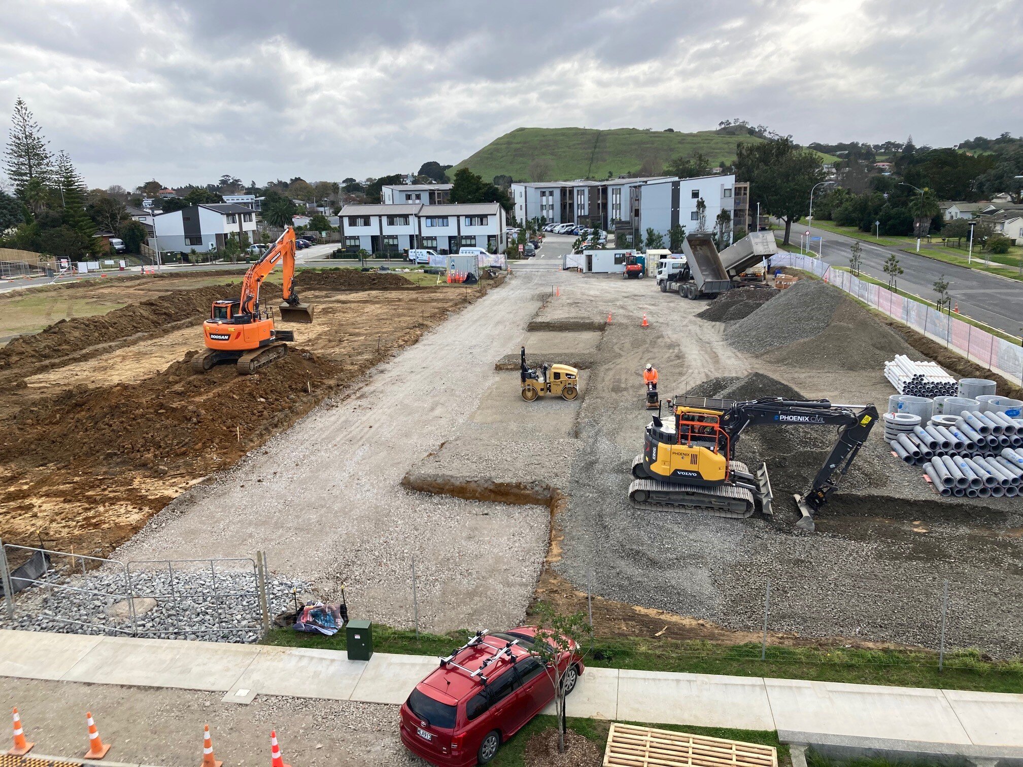
Mike Greer Homes | Mangere, Auckland and Christchurch, Canterbury
Warm, healthy, affordable homes for New Zealanders are in short supply. Bonisch is providing project management, civil engineering and survey services for Mike Greer Homes to deliver superlots which incorporate state housing; homes for first home buyers; and a greater supply of homes on the market generally, to house the growing population. The houses and apartments are designed to create living spaces that are warm and light, are well-designed and visually appealing. They help to improve the appearance of existing neighbourhoods while making better use of the limited land available for development.
Are you ready to
make your mark?
Surveyors, Civil Engineers and Planners in Christchurch, Invercargill, Te Anau and throughout New Zealand
Let’s talk about your next project.
As Southland's industries grow and transition to lower-carbon energy sources, investment in new electricity infrastructure is essential. Bonisch is supporting the delivery of the Hokonui Line project, helping strengthen the region's electricity network, enable future industrial growth, and support decarbonisation at Fonterra's Edendale site. The Hokonui Line, also referred to as the Edendale 110kV Connection, is a major electricity infrastructure project being progressed by The Power Company Limited (TPCL), with PowerNet delivering the build as part of the TPCL Group, in partnership with Transpower and Fonterra.
The project includes a new Grid Exit Point (GXP) at Cuttance Road, a 110kV overhead line connecting the GXP to a new substation at Fonterra’s Edendale site, and associated access roading. This infrastructure will increase electricity capacity in eastern Southland, improve network resilience, and support Fonterra’s transition away from coal-fired process heat through the introduction of electric electrode boilers and other site upgrades.
Bonisch is providing integrated planning, surveying, and engineering services across multiple stages of the project, from early development through to construction. Our involvement includes resource consenting and cadastral surveying for the subdivision of the GXP lot, design and construction support for the GXP access road, and surveying services for design, construction set-out, as-built information, and easement definition along the transmission corridor.
The Hokonui Line forms part of a broader investment in Southland’s future energy infrastructure, supporting industrial growth, network resilience, and decarbonisation objectives. Delivering a project of this scale requires coordination between electricity network operators, landowners, contractors, designers, local authorities, and a major industrial customer. The transmission corridor traverses rural properties and road reserves and includes significant infrastructure such as the new GXP facility, associated access upgrades, and a 110kV overhead line supported by large steel poles.
With planning approvals, land transfer requirements, road design, procurement, construction, survey set-out, and easement establishment progressing concurrently, maintaining alignment across project workstreams has been critical. Close collaboration between stakeholders and technical disciplines ensures land requirements, approvals, design decisions, construction activities, and long-term asset protection measures are coordinated throughout delivery.
Bonisch’s Planning team has supported the approvals pathway for the GXP site, including the subdivision required to create the GXP lot from the surrounding farmland. This work established the planning and cadastral framework needed to enable development of the new electricity infrastructure.
Our Surveying team has provided topographical surveys, construction set-out, as-built surveys, and easement definition services to support both design and construction. The establishment of easements is a key component of the project, securing long-term protection of the transmission corridor while balancing the interests of affected landowners.
The Engineering team has delivered design, procurement, and construction support services for the GXP access road, including tender documentation, contractor engagement, and construction monitoring. The team has also supported the wider transmission line works through contract administration, independent certification, procurement documentation, and construction support.
By combining expertise across Planning, Surveying, and Engineering, Bonisch has provided a coordinated service that streamlines project delivery and helps maintain consistency across all stages of development. Technical, planning, and land-related requirements have been integrated into a single delivery approach, allowing information and decisions to flow efficiently between disciplines and stakeholders.
The Hokonui Line demonstrates the value of a multidisciplinary approach to complex infrastructure projects. Through coordinated support across planning, land development, design, procurement, surveying, and construction, Bonisch has helped maintain alignment between stakeholders, approvals, and delivery requirements. The project will play an important role in supporting Southland's future energy needs, regional economic growth, and the transition to a lower-carbon future.